
Piscatus3D Product Range
DEEP SEA PRO l INSHORE PRO l RECREATIONAL l COMPARE FEATURES
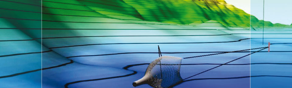
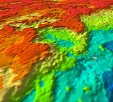
Piscatus3D is a comprehensive 3-Dimensional fishing tool that displays in superior detail, exactly what is happening underwater in real-time as you fish. With an interface designed by fishermen for ease of use, view your underwater fishing grounds as never before. Piscatus3D shows your boat, the seabed, the target fish and your fishing gear. Built on a stable and reliable technology platform, Piscatus3D automatically saves your data as you fish. Piscatus3D is available in three customised applications designed specifically for your fishing operations: Inshore-Pro, DeepSea-Pro and Piscatus Classic for recreational fishing.
 Deep-Sea Pro
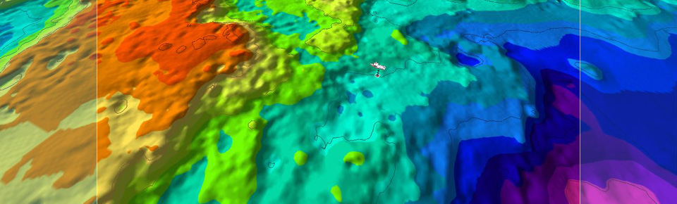
Designed for the “big boys” of the sea, DeepSea-Pro is a more efficient system by storing less data it is able to maintain bigger map sizes in deeper water without reducing ocean floor detail. Deepsea-Pro is recommended for vessels that work almost constantly over 1000 metres or require 3D maps larger than 20Nm. View stunning 3D maps of the seafloor in real-time.
 Inshore-Pro
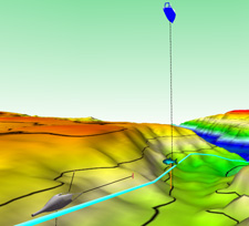
Inshore-Pro produces the highest detail of the seafloor because of its finer data resolution and depth accuracy. For most vessels Inshore-Pro is the correct choice as it can give higher detail in shallow water and allows the user to view smaller areas. Although designed to be used in less than 1000 metres it is able to store and display data down to 3200 metres.
 Recreational
Piscatus3D Classic is designed for recreational fishing, lowering the computer specifications required from the professional versions. With Piscatus3D Classic fisherman at sea or on a lake can accurately map their favourite fishing grounds and enjoy the hunt of fishing.